The Road to Sequoia.

This multi-part series was first published in The Kaweah Commonwealth in tribute to African-American History Month, beginning with the February 16, 1996 issue.

By Jay O’Connell, Febuary 1996,  Kaweah Commonwealth

Portrait of Charles Young in 1903 (courtesy of the United States Army)

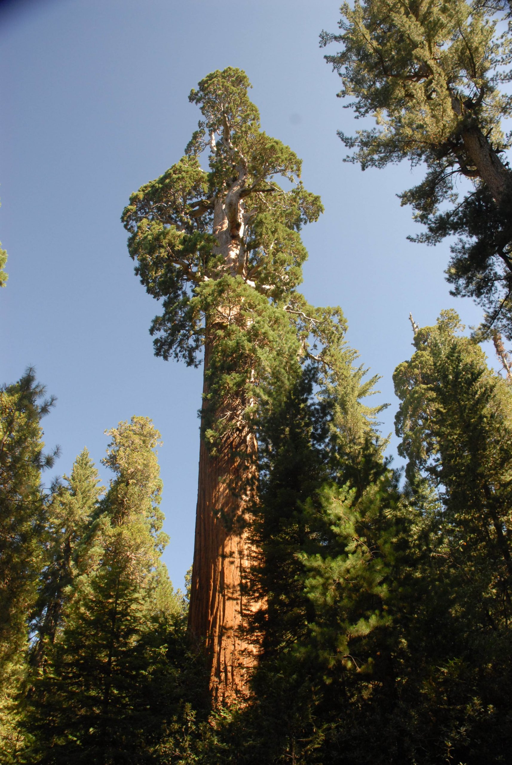
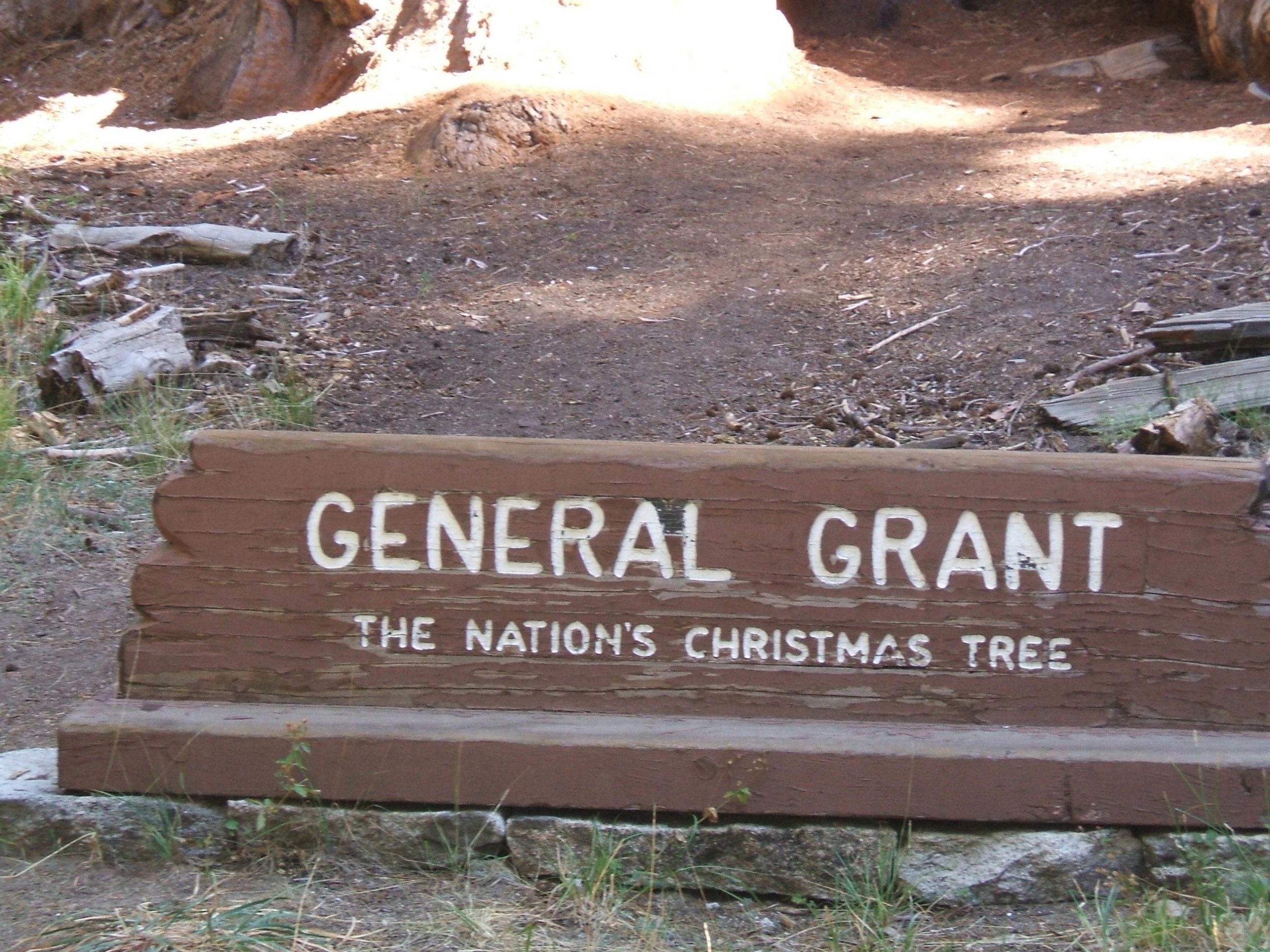
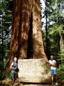
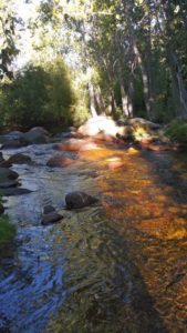
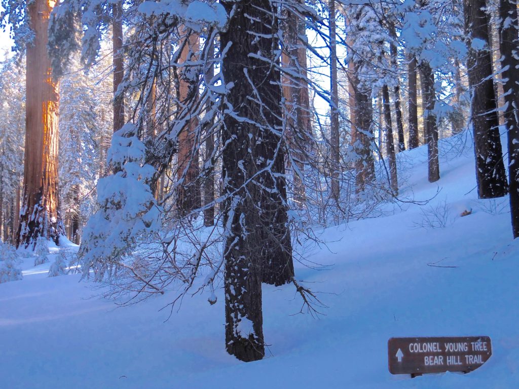
In 1903, Charles Young was military superintendent of Sequoia National Park and General Grant National Park (the predecessor to Kings Canyon National Park), where one of his several major achievements was completing the road the Kaweah Colony had started to Giant Forest.

During his brief time in Kaweah Country, Charles Young had as great an impact on local history as anyone before or since.

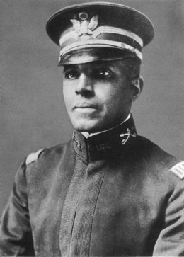
The third African-American ever to graduate from West Point Military Academy, Young faced numerous difficulties due to racial prejudices that, while time has eased, are still prevalent today.

In upcoming installments, we will look at Charles Young and his remarkable military career, examine the impact he had on this area’s history, and share some of the local anecdotes that have been handed down generation to generation about this great American.

PART ONE

Troops I and M (colored) of the 9th U.S. Cavalry arrived in Visalia this morning en route to the Sequoia National Park. The two troops are under the command of Captain Charles Young… a colored man and the only officer in the United States Army of his color and rank. He is a graduate of West Point and is a man of brilliant parts. His career has been one of hard struggle against prejudice of race. He has, however, risen above all these difficulties by force of character and inherent ability. —Tulare County Times, June 4, 1903

Charles Young was born in Mayslick, Kentucky, on March 12, 1864, to Gabriel and Arminta Young. His parents, both former slaves, moved the family north to Ripley, Ohio, after the Civil War.

Charles graduated from the formerly all-white Ripley High School at 16 years of age. In 1883, having become a teacher there, Young was encouraged by the principal to apply for examinations to West Point.

Earning a high application score, Young was invited to take the preliminary examination. He placed 22nd out of 100 candidates and in June 1884 arrived at the famed military academy.

Things soon proved difficult for the cadet who was accustomed to excelling scholastically. In 1885, he was turned back to the fourth class due to a deficiency in mathematics. When Young graduated from West Point in 1889, he was ranked 49th out of 49.

John Grunigen, Three Rivers pioneer and among the first Sequoia Park rangers, revealed that Charles Young once told him that the worst thing someone could wish on a person was to “make him black and send him to West Point.”

Nonetheless, Young did graduate West Point — only the third African-American to do so — and was commissioned as a second lieutenant.

Later in life, Young admitted to Phil Winser, former Kaweah colonist and local apple rancher, that he “went through hell to get his commission and so had no fear for future life.”

After an initial appointment to the 10th Cavalry and reassignment to the 25th Colored Infantry Regiment, Young finally reported to a preferred assignment with the 9th Cavalry at Fort Robinson, Nebraska, in November 1889. According to post records, Young’s time at Fort Robinson was not without blemishes.

His file contains a complaint of “tactical errors” as officer of the guard. A reprimand for neglect of stable duty also mars Young’s record.

In October 1890, Lt. Young’s troop was assigned to Fort Duchesne, Utah. It was there that he was again able to utilize his talent as an educator.

Young served as officer-in-charge and teacher of the post school until March 1894, when he was called upon to fill the shoes of a fellow graduate of West Point. Lt. John Hanks Alexander had been the second African-American to graduate the U.S. military academy, and when he died at just 30 years of age, he was serving as military instructor at Wilberforce University in Ohio.

Young’s career was already tracing Alexander’s, who had graduated West Point two years before Young and also served at Forts Robinson and Duchesne. After Alexander’s death, the head of Wilberforce wrote President Cleveland requesting the appointment of Young to the University. In May 1894, Charles Young assumed duties as Military Instructor at Wilberforce.

In December 1896, the Cleveland Gazette reported that Young had passed the examination for promotion to first lieutenant and “would now be paid $1,800 per year, has a handsomely furnished home free, and is only 32 years old.” The newspaper failed to mention that when Lt. Young was in Leavenworth, Kansas, for the examination proceedings, he could not get accommodations in town due to his race and had to stay in Kansas City.

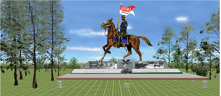
The Spanish-American War brought further distinction to Charles Young. In May 1989, he was granted a leave of absence from the regular U.S. Army to accept appointment in the 9th Ohio Battalion National Guard as a field officer with rank of major.

According to the Richmond Planet newspaper, this was the first instance “in which a colored officer has commanded a battalion.” Robert Greene’s book, Black Defenders of America, notes that the 9th Battalion was assigned to the 2nd Army Corps at Camp Russell, Virginia, then Camp George G. Mean in Pennsylvania, and finally in Summerville, South Carolina. “Young did not see service in Cuba during the Spanish-American War,” it was stated.

But this claim has been disputed. During the Spanish-American War, he was in command of a segregated squadron of the 10th Cavalry Buffalo Soldiers in Cuba. 

It has been written that Young charged San Juan Hill (Cuba) alongside Teddy Roosevelt and his famed Rough Riders. Phil Winser of Kaweah, who became good friends with Young in 1903 when he was stationed in Sequoia and corresponded for years afterward with him, wrote in his memoirs that Young was “promoted to a captaincy for conspicuous bravery at San Juan Hill.”

Many Buffalo Soldiers did see service alongside Teddy Roosevelt’s Rough Riders, and African-American troops from the 9th and 10th Cavalry later paraded with President Roosevelt. 

In 1899, Young rejoined his unit at Fort Duchesne. There he was involved in disputes between Native Americans and local sheepherders and demonstrated a talent for diplomacy.

In 1901, Young was assigned to the recently acquired Philippines. Young commanded troops at Samar and participated in numerous engagements against insurgents. It was during this time that he received his promotion to captain.

On December 27, 1902, the Indianapolis Freeman newspaper reported the following:

The colored officer of the 9th Cavalry, who will in the future be stationed at the Presidio, was a great favorite on the Sheridan coming from Manila to San Francisco and was in great demand. His skin is of the darkest hue of the race, but he is exceedingly clever, a West Point graduate, and a pianist of rare ability.

On May 20, 1903, Captain Charles Young was appointed acting superintendent of Sequoia and General Grant National Parks. In the days before the National Park Service was created (1916), the management of national parks was the responsibility of the U.S. Army, which had very little Congressional funding for the task.

The giant sequoia named in honor of the accomplishments of then-Captain Charles Young in Sequoia National Park is located along the Crescent Meadow Road in the famed Giant Forest.

PART TWO

In 1903, Captain Charles Young, stationed at the Presidio in San Francisco, could already boast of an accomplished military career. He was described in the Visalia Delta as “a man of medium build, very erect, well preserved and though he says he is 39 years old, he looks scarcely 25.”

Young received orders to report to Sequoia, and on May 20, 1903, departed San Francisco with Troops I and M, Ninth Cavalry, consisting of three officers and 93 enlisted men. After a 16-day journey, they arrived at Kaweah.

“A general supply camp was established and maintained there throughout the year, as it is centrally located,” Young recalled. “The ground for this camp was kindly offered to the troops by Mr. Ralph Hopping.”

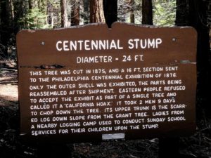
The first order of business was an inspection tour with Ranger Ernest Britten, who had served in Sequoia since 1900. He had already begun repair work on the existing road, which continued the Kaweah Colony road toward Giant Forest (pre-Generals Highway).

The route of extension, still several miles shy of completion, was also viewed with construction engineer George Welch, who had worked on the road for several of the previous summers.

It was imperative they begin road work right away. George Stewart, an original agitator for Sequoia’s establishment, wrote to the Secretary of the Interior on April 14, 1903, explaining that “a large number of people will visit Giant Forest this year, and it is desirable that the road building [commence] at an early date.”

On June 4, Young telegraphed the Secretary, requesting permission to begin work immediately.

“Laborers are on the grounds now,” he explained, and claimed that hundreds of dollars would be saved by beginning work before the ground became hard and dry.

Work commenced June 11, 1903, and on June 20 the Visalia Delta boasted that Captain Young would have the road “smooth enough for automobiles and bicycles.”

The Delta also noted Young’s admiration for his inherited ranger staff, quoting him as saying, “The people who rely upon Ranger Britten to prepare and build trails do not realize his ability to do that work to perfection.”

Ernest Britten also displayed administrative skills appreciated by Captain Young. Writing the Secretary of the Interior, Britten suggested a system of vouchers to guarantee payment to suppliers and asked that money to pay the laborers be entrusted to the officer in charge. Young heartily recommended this request be approved, reasoning that it would greatly facilitate matters, as keeping vendors and workers promptly paid would avoid delays in completing the road.

Most of these men earned two dollars a day as laborers, with foremen earning three dollars per day. George Welch, the civil engineer overseeing the project, earned an impressive $150 per month.

In addition to starting early in the season and keeping men and suppliers promptly paid, one factor was key to the success of the 1903 road-building crew. Captain L.W. Cornish, Young’s eventual replacement, considered it “largely due to the strict personal supervision given by Captain Young, who continually spurred on the men under his employ.”

Young had long before earned a reputation as a strict disciplinarian. His Ninth Ohio Battalion had been considered “one of the best drilled in the volunteer army.”

Captain Young was also a fair and generous leader who knew the importance of rewarding a job well done. Examining National Park Service archives, one finds a letter he wrote to his superior explaining a 10-day absence by Ranger L.L. Davis. Young had insisted Davis take the time off, with pay, after he had supervised the blasting on road construction.

“I ordered him away from duty for rest because of the ill effects of close contact and long use of dynamite,” Young informed Secretary Hitchcock. “If the exigencies of ranger service will not permit him to have those days so richly deserved by him, I shall be glad to refund the money paid him by the department.”

The best example of Young’s rewarding hard work was a well-publicized event in Sequoia National Park’s early history. On September 1, the Visalia Delta offered this report:

The great feast that was given last Sunday at Giant Forest by Captain Young, and the splendid road that has been perfected into the forest are themes of conservation among Visalians who attended…

The elegant feast was put upon the table and some hundred or so guests sat down to honor the completion of the road. The menu consisted of roasted chicken, roast pork, beef, and all the delicious dishes that are served to make them all the more palatable.

Those from this city who sat about the festal board speak in glowing terms of the hospitality of Captain Young and his ability to entertain.

The celebration was the talk of Kaweah Country for a long time. Young had encouraged the workmen by promising this feast upon completion of the road. Everyone who worked on the road, as well as Visalia dignitaries, were invited. The banquet was set out on a huge log and Young, acting as head waiter and assisted by his non-commissioned officers, served the guests from blasting powder boxes attached to shovels.

One account mentions Young’s truly appreciated grand finale. When they were about finished, he announced that this wasn’t all. He had beer — store-bought! — for everyone.

Young was well liked in Three Rivers. He purchased local rancher Marion Griffes’s house during that summer, so it is apparent he was fond of the area and hoped to stay. After completing the road, Young concentrated his efforts on obtaining options for the government to purchase privately owned land in Sequoia. Sequoia National Park seemed to be in Captain Young’s future.

Even Captain Cornish, who technically replaced Young as park superintendent in September due to seniority, stated in his official report, “Owing to the good work performed by Captain Young, Ninth Cavalry, during the present season, I recommend his permanent detail on this duty as long as he is available.”

The design by the Buffalo Soldiers Association of West Point for a Buffalo Soldier Monument on the campus.

PART THREE

From the Visalia Delta (October 13, 1903)— In an interview, Captain Young said that he with the other proper officials have seen, or corresponded, with, all of the people who own property within the park lines and have secured their consent as to the sale of the land to the government. As will be remembered, nearly every captain that has been here on duty has made an effort to purchase the private land within the boundaries and convert it into the park.

* * *

Acquiring options on all the privately held land in Sequoia National Park was an impressive feat. Reading the promissory letters in the Park files, it is apparent that Young received help in obtaining them. Several of the notes are addressed to Ranger Ernest Britten, and in one case, George Stewart acted as liaison.

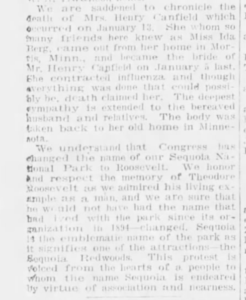
Unfortunately, Congress failed to act on Young’s recommendation and would not appropriate the necessary monies to buy the land. The problem of dealing with privately owned land within Sequoia would haunt the national park for many years to come.

Still, just obtaining the options was further evidence of Captain Young’s effectiveness as superintendent of Sequoia National Park in 1903. It is testimony to his ability to utilize Britten’s talents and local connections, as well as his own considerable, and somewhat legendary, charms in convincing settlers to sell their land.

That Captain Young charm is best exemplified, perhaps, in the following local anecdote.

Once, while on patrol near Oriole Lake (8 miles up the present-day Mineral King Road), Young and a number of his Buffalo Soldiers (a complimentary term for the African-American troopers) stopped at the Grunigen’s Lake Canyon house on the Mineral King Road. (The Grunigens were the parents of John Grunigen who had worked on the road for Young.)

It was getting late and Young asked Mrs. Grunigen if she would feed his men. She prepared a meal and invited the soldiers to eat.

Young told her he would have his men file through the kitchen, pick up their plates of food, and take them outside. Mrs. Grunigen informed him that they would do no such thing. They would eat under her roof or not at all.

As Mrs. Grunigen was from Alsace, she was fluent in German and French, but her English was shaky. After dinner, as the soldiers set up camp for the night. Mrs. Grunigen and Captain Young sat out on the front porch and conversed in French until well past midnight.

Young also became good friends with the Winsers. Phil Winser had come from England to join the Kaweah Colony and subsequently started at apple orchard with Fred Savage on the North Fork. Young had once told Winser that he had “come to Kaweah with his heart full of bitterness and left it a different man with a better outlook.”\

In one letter, dated January 6, 1904, Young wrote:

“Oh beautiful valley! You are right, Mr. Winser, when you speak of the charms, due in large measure to the people living there. It will likely be impossible for me to get down now, even though we pull free of the Panama Muddle.”

Despite his desires and others’ recommendations, Young did not return to service at Sequoia. On May 13, 1904, he assumed duties as military attache to Haiti. It was undoubtedly upon learning of this assignment that Young sold Marion Griffes’s Three Rivers house back to him and prepared to relocate to Haiti with his new bride.

Young’s career after Sequoia included several years in Haiti. He later served, at the personal urging of Booker T. Washington, as military attache to Liberie. In September 1915, Major Charles Young was officially assigned to the 10th Cavalry Regiment.

On February 22, 1916, he received the Spingarn Medal for outstanding service in Liberia and, in 1916, Young served in Mexico as part of the Punitive Expedition with General John Pershing. He led a fight against Pancho Villa at Aguas Calientes and his 10th Cavalry came to the rescue of the 13th Cavalry at Santa Cruz de Villegas.

It was written that Major Tompkins of the 13th, upon their rescue, exclaimed, “By God, Young, I could kiss every black face out there.”

In July 1916, Young was promoted to Lieutenant Colonel. As Young earned a higher and higher rank, racial prejudice became more of a problem for the Army due to resentment from other officers.

In 1917, Young was ordered before a retirement board. Young had battled malaria in Liberia, and the lingering effects were justification for his retirement.

In 1918, after America had joined the “war to end all wars,” the patriotic Young rode on horseback from his home in Ohio, 500 miles to Washington, D.C., to prove he was still fit for active duty. He was recalled to service and assigned to Camp Grant, Illinois. In 1919, he returned to Liberia as military attache.

Young’s ride to Washington was just one more example of the determination that defined his career. He refused to let the difficulties connected with the racial temperaments of his America get to him. While he could not ignore them, he was able to deal with them in whatever manner most effective. 

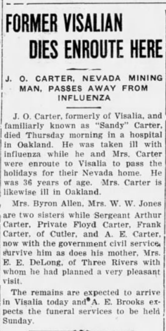
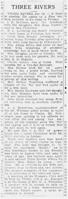
One example turns up again and again in Charles Young’s life. The episode is reported to have taken place in Virginia, San Francisco, and in Three Rivers.

The local version recounts how Captain Young’s troop was all “Negro except for one white doctor and two white Lieutenants.” Once, at the old Three Rivers Store, the two lieutenants deliberately walked by the Captain without saluting.

Young whipped off his shirt and hung it on a fence post, brought the boys back, and said, “You don’t have to salute me but, by God, you’re going to salute the bars!”

And they did.

On January 8, 1922, Colonel Charles Young, on duty in Lagos, Nigeria, died from an acute exacerbation of an old-standing illness. His body was brought back to the United States, and he was given a hero’s burial at Arlington National Cemetery.


Jay O’Connell was raised in Three Rivers and currently lives in Southern California. He is the author of several acclaimed historical works, including TRAIN ROBBER’S DAUGHTER: THE MELODRAMATIC LIFE OF EVA EVANS, 1876-1970. His first book–CO-OPERATIVE DREAMS: A HISTORY OF THE KAWEAH COLONY–is considered the definitive study of that late 19th-century utopian community in present-day Sequoia National Park. He is also the co-author of A STRENGTH BORN OF GIANTS: THE LIFE AND TIMES OF DR. FOREST GRUNIGEN, the biography of an accomplished California osteopathic physician.  When not researching and writing about California history, Jay O’Connell works in the television industry as a producer and production manager for Warner Bros. Television. Some of the television series he has worked on include THE BIG BANG THEORY (CBS), 2 BROKE GIRLS (CBS), GOOD MORNING, MIAMI (NBC), and $#*! MY DAD SAYS (CBS) with William Shatner.


What’s the story behind the second largest giant sequoia and the controversy with its naming myth?

By Sarah Elliott, 16 April 2019, 3RNews; editorial update 31 March 2021

There is no other tree on Earth that has had such attention and honor bestowed upon it by U.S. presidents than the General Grant Tree.

The General Grant Tree is the second largest tree by volume in the world.* It is 268.1 feet in height, almost seven feet shy of the General Sherman Tree, the largest tree.

Named for Ulysses S. Grant (1822-1885), the Union general and 18th president of the United States, it was designated as the Nation’s Christmas Tree by President Calvin Coolidge on April 28, 1926. The General Grant Tree is also a living memorial to the men and women of the United States who have given their lives in service to their country. It was proclaimed a National Shrine on March 29, 1956, by President Dwight D. Eisenhower.

Naming the Tree

General U. S. Grant, City Point, Va., August, 1864 (Library of Congress)

The tree was purportedly discovered by Joseph Hardin Thomas in 1862. According to Park Service lore, it  was reportedly named by Lucretia Baker of Visalia on Aug. 20, 1867, while General Ulysses S. Grant was still in command of the Union armies, however, there is some controversy in my family about who really named the tree.

My great-great-uncle, Hudson Barton (1844-1929), was once quoted as saying: “In 1866, one year before it is claimed that Mrs. Baker named the tree, I myself held a tapeline to my belt and walked around the General Grant Tree. I found it to be 106 feet in circumference. The tree was known as the General Grant Tree at that time. I further state that I was told by Joseph Hardin Thomas, owner of the sawmill in Shingle Flat [now Sequoia Lake] that he himself discovered and named the tree. Thomas made this statement in the presence of men who could have disputed it had they knowledge to the contrary.”

Mrs. Baker did send General Grant a frond from the tree, and Grant responded with a letter recognizing the honor.

Grant is well known for his victorious exploits in the Civil War. But at Shiloh (Tennessee) in April 1862, Grant fought one of the bloodiest battles in the West and came out less well.

For his next major objective, Grant maneuvered and fought skillfully to win Vicksburg, the key city on the Mississippi, and thus cut the Confederacy in two. By the end of 1862, he broke the Confederate hold on Chattanooga. Then, on December 17, 1863, Union General Ulysses S. Grant expelled all Jewish people from the Department of Tennessee, which included parts of Tennessee, Kentucky, and Mississippi, based on anti-Semitic stereotypes and rumors. He gave Jewish people just 24 hours to leave their homes, businesses, and lives behind. When Lincoln heard of the order, he was so shocked that he asked his staff for confirmation. Once they confirmed that it was real, he revoked it.

Annual Trek to the Tree

The first Christmas service at the base of the tree was inspired by the late Charles Lee of Sanger. In 1924, as he was gazing in awe at the huge tree, a small girl approached. “What a lovely Christmas Tree that would be,” she said, then turned and ran off.

The idea stayed with Lee and on Dec. 25, 1925, he organized the first Christmas program at the tree. Upon returning home, Lee wrote a letter to President Coolidge, who adopted Lee’s suggestion.

Christmas services have been held each year since, except during World War II when travel was restricted. The ceremony is sponsored by the Sanger Chamber of Commerce.

At the annual event, the National Park Service places a wreath at the base of the tree in honor of our fallen heroes.

Getting there

It is located just inside the Kings Canyon National Park entrance in the Grant Grove. Turn left off of Highway 180 one-quarter mile past Grant Grove Village. Travel 1.2 miles past Azalea Campground and Columbine Picnic Area. It is an easy, quarter-mile walk to the General Grant Tree from the parking lot, where also seen will be the Fallen Monarch, which has been historically used as both living quarters and a stable; the Gamlin Cabin, home to brothers Israel and Thomas Gamlin in the 1800s while they worked their 160-acre timber claim in the Grant Grove; and the Centennial Stump, all that’s left of a Big Tree that was cut down in 1875 for display at the World Exposition in Philadelphia.

*NOTE: The General Grant was not always deemed the second largest tree. The Washington Tree held that honor untl the summer of 2003.

2003 was a tough fire year. The Dinely Fire in Three Rivers, Calif., created many tense moments for homeowners. Antelope Mountain in Woodlake burned.

In Sequoia and Kings Canyon National Parks, fire crews were busy balancing prescribed fires and several lightning-caused blazes, including a particularly destructive one in the Giant Forest. Although orders were given to create a perimeter around the Washington Tree and protect it from the approaching fire, something went horribly wrong. Word slowly trickled out that the second largest tree in the world had caught fire.

The Washington Tree, located in a remote corner of the Giant Forest Grove, is these days a shell of itself; its defining branch, bigger than most mature trees, is on the ground in a charcoal heap. As of this writing, the Washington Tree has been removed from this list of the “Biggest of The Big Trees.” It no longer holds the distinction of #2.


The planet’s 4th largest tree by volume was dedicated Aug. 10, 1923, in honor of President Warren G. Harding, at the hour of his funeral.

By Sarah Elliott, 16 April 2019, 3RNews

The President Tree is the fourth largest tree in the world. It is easily accessed via the Congress Trail in Sequoia National Park’s Giant Forest.

The Congress Trail is a paved loop trail that begins and ends at the General Sherman Tree parking lot. It is a self-guiding trail and, although the most famous of the named trees are also graced with carved, wooden signs, there are pamphlets available at the trailhead that correspond with numbered markers along the trail that discuss various natural features of the forest.

The Congress Trail leads in many different directions as it meanders through the Giant Forest.

It is also advised to travel in this area with a map in hand (available at park visitor centers). There is a network of trails criss-crossing the Giant Forest plateau and though most junctions are marked, it’s easy to become confused.

To reach the President Tree, take the Congress Trail — which is marked with a sign just east of the Sherman Tree — into the forest past the Leaning Tree, where the route then turns south.

In less than a tenth of a mile, the trail crosses Sherman Creek. Although above the return loop portion of the trail, it can be intermittently seen below.

The trail climbs gently, and in just over one-quarter of a mile, crosses another tributary of Sherman Creek. A trail junction is reached in under a half-mile that connects with the return loop.

Stay left here and continue to gradually ascend on the Congress Trail south. At just over three-quarters of a mile, the trail meets the Alta Trail.

This is where a slight detour will allow a glimpse of the beautiful Chief Sequoyah Tree. Instead of turning right on the short portion of the Congress/Alta trails just before they again go their separate ways, continue instead straight, crossing the Alta Trail.

This one-tenth of a mile segment is part of the Trail of the Sequoias, a six-mile loop trail that explores the highest reaches of the Giant Forest plateau, as well as Log, Crescent, and Circle meadows, Tharp’s Log, and provides access to several other trails in the area.

About 500 feet south of the Alta Trail on the Trail of the Sequoias, the Chief Sequoyah Tree comes into view. It is reached by a short spur trail that ascends to the left.

The Chief Sequoyah Tree was named in 1928 by Colonel John R. White, park superintendent, for the man who developed an alphabet for the Cherokee people, one of the greatest intellectual feats of all times. German botanist Stephen Endlicher, who originally named the trees sequoia gigantea (the Big Trees are now botanically known as sequoiadendron giganteum) and sequoia sempervirens (coast redwood), did so in Sequoyah’s honor, but changed the spelling to how it appears today.

Back on the trail, the President Tree is in sight on the right side of the trail, an easy jaunt of one-tenth of a mile. The President Tree was dedicated Aug. 10, 1923, in honor of President Warren G. Harding, at the hour of his funeral.

Presidents of the United States well understand the checks and balances provided by their various branches, and for this, the President Tree is aptly named. It’s branches are high up, large, and powerful, keeping the main body of the President, its trunk and lifeline, upright and true despite the species’ shallow roots system.


The planet’s 5th largest tree by volum was named in 1960 for Amos Alonzo Stagg (1862-1965), a college football coach.

By Sarah Elliott, 7 October 2019, 3RNews

The fifth largest tree on the planet is the Amos Alonzo Stagg Tree. It is also the largest tree outside of Sequoia and Kings Canyon National Parks and has had the distinction of being the largest tree in the world that is located on private land.  (But, perhaps, not for much longer. The Rouch family sold the Alder Creek Grove to Save the Redwoods League.)

The Stagg Tree is located off Highway 190 east of Springville.

To reach the Stagg Tree, drive east on State Highway 190 for 2.5 miles beyond Camp Nelson. Turn left on Redwood Drive (County Route M216) at the subdivision of Alpine Village and continue about 6 miles to the cabin community of Sequoia Crest. When Redwood Drive turns sharply left to become Alder Drive, drive straight ahead on the unpaved road for less than a half-mile to the locked gate.

From here, it’s less than a one-mile walk to the tree. Continue beyond the gate along an old logging road. Stay on this road as it passes through an old logging camp – with its unmistakable twin towers of giant sequoias – until reaching a short trail that is identified by a handmade sign pointing the way to the tree, which is a short walk downhill.

The land on which the Alder Grove grows is owned by the pioneer Rouch family. It is from this grove that a 25-foot-long block of downed giant sequoia wood was donated to sculptor Carroll Barnes of Three Rivers and during 1941-1942 was transformed into a statue of Paul Bunyan. The 20-foot tall, 13-ton statue has stood sentry at several Three Rivers locales and wandered as far as Porterville in southern Tulare County, but today calls Three Rivers Historical Museum home and greets all passersby on Sierra Drive.

This impressive carving has had several homes over the past 80 years, but today stands along Highway 198 in front of the Three Rivers Historical Museum. The sculpture is 17 feet tall, 9 feet wide, and weighs 13 tons.

The present-day owners of the Alder Creek Grove is the Rouch (pronounced ra-ow) family who are kind enough to grant public access so all may visit this fifth largest of all trees. (Be sure to follow all parking directions and refrain from smoking and littering.) 

The Alder Creek Grove is about 785 acres and contains stands of young and mature sequoias. Although the Rouch family were loggers and developers throughout much of the 20th century, they never cut a giant sequoia.

When my husband, John, and I visited the tree, we were joined by two couples who were visiting from Russia. On our return hike we met other groups on pilgrimages to the tree.

The Stagg snag bears the scars of thousands of years of being pummeled by lightning and winter storms.

The tree was named in 1960 for Amos Alonzo Stagg (1862-1965), immortalized college football coach whose career spanned 70 years. He also coached track, baseball, and basketball.

Stagg helped organize what is today the Big Ten Conference and is credited with many innovations in the game of football, from formations to uniforms and equipment. He was inducted into the College Football Hall of Fame as both a player and a coach.

According to measurements taken by Wendell Flint (To Find the Biggest Tree, 2002), the tree has reached a height of 244 feet and has a ground perimeter of 82.2 feet.

The Stagg Tree is on a steep slope, which makes it difficult to judge its true size. It has several burn scars and extremely thick bark.

Not only are sequoias the largest trees on earth, they are also the most enduring. Big Trees can live to be thousands of years old, mainly because they don’t usually die of natural causes.

The secret to this everlasting life is the giant sequoia’s outer bark, a fibrous, deeply furrowed, almost fur-like reddish-brown cortex. In the oldest of the trees, the outer bark can be up to two feet thick.

The leading cause of death for giant sequoias is fire. And in a complete contradiction, the giant sequoia also depends on fire for survival.

When the fuel of smaller trees such as pine and fir and accompanying forest shrubs build up the understory and encroach upon the Big Trees, a fire will burn with too much intensity, ultimately working through the sequoia’s protective outer bark to its thinner, more vulnerable inner bark.

Giant sequoias: The aging process

In contrast to a conflagration, occasional small fires burn away accumulated fuel. The sequoia seeds then germinate on the bare, mineralized soil.

A sprouting sequoia seed actually grows faster downward during the first several years of life, its taproot growing deep into the ground.

Above ground, through its adolescent years of a hundred years or so, the sequoia tree is conical with gray bark, blue-green foliage, and feathery limbs. A sequoia is fast-growing, adding about six feet per year.

As it ages, the trunk bares itself of branches and the needles turn greener. It’s only after a millennium or more that the tree’s bark turns to a cinnamon color and becomes deeply furrowed.

By then, its upper branches have grown as large as most trees. The largest will have jutted from the tree horizontally, as branches tend to do, but then form an elbow and grow skyward as if declaring their independence from the massive trunk.

The realm of massive trees once covered most of the Northern Hemisphere during an age of gigantic things. Although dinosaurs have long been extinct, the Big Trees continue to survive.

Today, giant sequoias have chosen to grow naturally only in groves located in the mid-elevations along the western slope of the Sierra Nevada Mountains.

We must never take these primeval trees for granted. Travelers from across the globe flock to see those that have chosen to grow so close to Three Rivers.

Update:

This article was originally published August 2011 in The Kaweah Commonwealth newspaper. Claud “Sonny” Rouch, 92 and then-patriarch of the Rouch family, corresponded upon learning of the feature. Sadly, Sonny died in February 2012 so my email conversations with him abruptly ended. Here are some of his insights from his original email:

Dear Sarah:

I’m told that your paper had a good article about the STAGG TREE. My family owns the land where that tree is located. There is a long  and very interesting story which if you wish I will share it with you.

I have lived in Camp Nelson for over 50 years, My dad bought the land where the Stagg Tree is located in 1945. There was no road there at that time.

In the fall of 1945, coming home from service in the army, my first job was to build 6 miles of road to this full section of land which included the STAGG TREE. This area of Sequoias is named the South Alder Creek Grove.

We had a saw mill in Springville. Fortunately we didn’t cut the redwoods.

We then subdivided about 200 acres. This is now known as Sequoia Crest and there are now over 100 mountain homes built there.

This is enough for now. If you wish in the future I have a story of working for Disney in Mineral King. I worked for the Tulare County Road Dep. when the flood of 1969 took out the Kaweah Northfork road.

Sonny Rouch


Like many popularly-accepted community histories, the Woodlake narrative tends to exclude or marginalize the women, Native Americans, Chinese, and other disenfranchised groups who played important roles in the community. How would you augment this narrative?

By Sarah Elliott. Published 20 April 2019, 3RNews

Bravo Lake in Woodlake is a birdwatchers paradise.

Early cattlemen knew the area as Antelope Valley. There were rolling green pastures and plenty of water, including Bravo Lake, from which Woodlake takes its name.

Bravo Lake has an even more colorful history as to how it was named. As more and more ranchers discovered the bounty of the land in California’s Central Valley, there were also many disputes over stock ownership. Personal grudges became fistfights, with one of the more memorable clashes leading to a well-known county place name.

Tom Fowler and John Asbil had one such meeting, and the arena was the present-day town of Woodlake. As the fight went on, bystanders crowded around, yelling “bravo” so many times that the nearby body of water became forever known as Bravo Lake.

Along the shores of Bravo Lake, early settlers established Stringtown. In December 1867, the Kaweah River flooded and destroyed the small settlement, causing the inhabitants to relocate.

Redbanks Orchards (west of present-day Woodlake) was started in 1894, producing citrus, vineyards, peaches, and other orchard crops.

In 1907, Jason Barton of Three Rivers and J.W. Fewell and Adolph Sweet of Visalia bought and subdivided land in Antelope Valley, named it Elderwood and planted citrus groves.

In 1908, Gilbert F. Stevenson, a Los Angeles millionaire, developed the Woodlake townsite, south of Elderwood, with dreams of creating a resort town with Bravo Lake as the centerpiece. He purchased about 13,000 acres of raw land in the area with plans to create one of California’s great citrus districts for in this secluded valley there existed water, soil, and the ideal climate.

Stevenson platted the tract of land and placed a portion of it on the market. In 1911, he built a fireproof commercial district, known as the “Brick Block,” that contained shipping facilities and passenger depot, a bank, grocery store, barbershop, drug store, restaurant, hotel, and other businesses and, in the fall of 1914, the first high school classes.

The building was located on the southeast corner of Naranjo and Valencia boulevards, near the Visalia Electric Railroad tracks. Extending north, a business district began to develop; Woodlake Hardware opened there in 1917 and is still in business today.

There were good streets, electric light and water systems, sewers, a grammar school, and a church. On Jan. 30, 1908, an application was approved for a post office. In 1913, a weekly community newspaper, The Woodlake Echo, made its debut and continued publication until the 1980s.

By 1914, the bulk of the acreage in the Woodlake area had been sold. This planned community contained a population of mostly newcomers who came to the area during the years from 1907 to 1914. Hundreds of homes were built, irrigation facilities installed (wells and pumping plants), and citrus groves planted.

In 1914, one newspaper reported: “The result of this big project has been evidenced by the fact that today [1914] there is a population of 4,000 in the Woodlake district, including the town of Woodlake and the tributary territory and old time residents are so scarce as to almost be a curiosity up in that country. What this has added to the productive wealth and taxable values of Tulare County is unknown, but it certainly must mount into big figures and be it remembered that Woodlake citrus groves are just beginning to come into bearing now.”

Stevenson also donated 10 acres of land for the construction of a high school while agreeing to grade streets and lay sidewalks in the vicinity of the proposed facility. Classes were held in the Brick Block for two years until the completion of the new high school. The elegant, Spanish colonial-style buildings consisted of 13 rooms and a 600-seat auditorium.

The dedication program reported: “One thing that is remarkable about our school is that we have our own water supply, which no other school in the county has.”

In 1920, state legislation passed requiring that every elementary school become part of a high school district. Three Rivers voters approved unionization to the Woodlake High School District, forever linking the two communities.

Gilbert Stevenson lost his fortune during the Great Depression. He died nearly penniless in 1938, having spent more than $150,000 on his dream of developing Woodlake. Another legacy of Stevenson’s is the Sentinel Butte Ranch just north of town where he also took advantage of the region’s rich ranching resources and planted citrus groves and a vineyard. The historic ranch house and some outbuildings are extant.

On Sept. 16, 1941, Woodlake was incorporated.

Since 1953, Woodlake has been the site of the world’s largest ranch rodeo, sponsored by the Woodlake Lions Club. It is held every Mother’s Day weekend north of town on land that was formerly a part of the Jackson Ranch.

In 2000, the population of Woodlake was about 6,600. Cattle are still raised on the surrounding ranches, and citrus and olive groves encompass the city boundaries.

This summary account of the popularly-accepted history of Lemon Cove is typical of community histories in that it centers on one Euro-American man, in this case,  J. W. C. Pogue.  Look for the missing voices.

By Sarah Elliott, 20 April 2019, 3RNews

The former Pogue home and hotel, now the clubhouse of the Lemon Cove Women’s Club and on the National Register of Historic Places.

Lemon Cove, nestled in the foothills between Woodlake and Three Rivers, was first called Lime Kiln due to the lime deposits discovered in the vicinity in 1859. Lime Kiln Hill, an anchor point for the present-day Terminus Dam at Lake Kaweah, was the boundary between the Wutchumna and Potwisha Indians who lived along the Kaweah River.

The history of the community of Lemon Cove begins with James William Center (J.W.C.) Pogue (1839-1907). The Pogues came to California in 1857 and settled near Venice Hill (between Woodlake and Lemon Cove) in Tulare County in 1862.

After the flood of 1868, they moved to Dry Creek (north of Lemon Cove), where Pogue planted oranges and lemons. Until then, lemons were considered too tropical to grow in the San Joaquin Valley. When the family moved to what is now Lemon Cove, the citrus trees were transplanted successfully.

The Pogue home, built in 1879, served also as a hotel for many years and is now the headquarters of the Lemon Cove Woman’s Club.

Pogue Hotel, 1879-1903

The Pogue Hotel, originally called “The Cottonwoods,” was constructed by a ranching partnership formed in the 1870s by J.B. Wallace and C.W. Crocker of San Francisco, and J.W.C. Pogue, resident superintendent. At the height of the Mineral King silver rush, the Wallace, Crocker, and Pogue Company was organized for the purpose of buying ranch land to raise livestock.

Initially, the company grazed sheep; operations were expanded to cattle and grain farming. The ranch was known as the “Cove,” the area being well-suited for cultivation of grain.”

In 1881, Wallace died and the company was reorganized. Mrs. Wallace took her one-third, over 3,000 acres in the western part of the Cove, and the property became known as the Wallace Ranch.

J.W.C. Pogue purchased the Crocker share and became sole owner of the hotel and 6,000 acres. J.W.C. Pogue, who served two terms as a Tulare County supervisor, lived to see his vision of citrus groves in the land he pioneered. He was solely responsible for the introduction of lemons to Tulare County and the development of the townsite of Lemon Cove. It was evident that Pogue had discovered an ideal place for lemons. In 1885, he exhibited lemons at the Los Angeles Fair and won a blue ribbon.

The Pogue Hotel — as the two-story, 13-room lodging facility was known after the consolidation — accommodated travelers on the road to the Mineral King mining district and the Kaweah Colony. It was here that the Mineral King stage changed from horses to mules for the long uphill journey.

Timber teamsters, tourists, and other travelers found the hotel a convenient stopover. Meals were served to diners even if they weren’t overnight guests, and the hotel soon became a popular gathering place.

In 1894, J.W.C. Pogue surveyed 15 acres of the family ranch, dividing the parcel into 48 town lots. He named the town Lemon Cove, though later the post office changed the spelling to “Lemoncove” to avoid confusion with Lemon Grove.

The Pogue Hotel and Store (located on a lot north of the hotel and eventually contained the community’s post office) evolved as the town center and, in the early part of the century, the town’s population grew to 500. Although there was a hotel, store, post office, blacksmith shop, and more, there were no saloons. J.W.C. Pogue, who never smoked or drank, outlawed them within the town limits.

Montgomery-Pogue House, 1904-1936

In 1904, Nora Alice Pogue (1884-1984), the youngest of J.W.C. and Melvina Blair Pogue’s nine children, was deeded the Pogue Hotel, which had been her birthplace. In that same year, she married Dr. Robert Bruce Montgomery (1880-1966), Lemon Cove’s first resident physician and justice of the peace.

The Montgomerys remodeled the hotel and changed it into a single-family residence. After the hotel was converted to a residence, a small business block was developed in the vicinity.

James William Center Pogue returned to live with his daughter and her husband during the last years of his life. In 1907, he died there at the age of 68.

Lemon Cove Woman’s Clubhouse, 1936-present

In the 1930s, there was a consciousness on the part of local residents as to the historical importance and community function of the former hotel and current home. In 1936, Nora Pogue Montgomery, who had been a founding member of the Lemon Cove Community Club in 1924, deeded conditional use of the house and the one-quarter acre of land on which it is situated to the club.

This conveyance coincided with the official charter of the community club as the Lemon Cove Woman’s Club. The deed stipulated that the property would revert back to Pogue heirs in the event that the building was no longer used by the Lemon Cove Woman’s Club.

Today, the club still meets in this former hotel and home, which was listed on the National Register of Historic Places in 1991. The historic setting of the Pogue Hotel has changed very little since its construction in 1879.

The original decision as to building placement was influenced by the location of a nearby wagon road that connected Visalia and Mineral King. In later years, the old county road was improved and realigned, and the historic building is now on the east side of and adjacent to State Highway 198.

Lemon Cove has remained rural and is surrounded by cattle ranches and citrus groves. The small community has a post office, fire station, elementary school, two churches, small market, mini-mart, two 24-hour gas stations, a produce market/restaurant, citrus stands, and a campground.

The trail meanders along the south side of the East Fork of the Kaweah River through green high country meadows brimming with wildflowers, willows, and aspens. The destination is history.

By Sarah Elliott, 14 April 2019, 3RNews

This article was originally published July 5, 1996, in The Kaweah Commonwealth newspaper’s Hiking the Parks series.

Start here.
The iron tint from the Iron Springs.

The Nature Trail is a mile, mile-and-a-half, easy trail that takes hikers of all levels from Cold Springs Campground to the road’s end at the east end of the Mineral King Valley.

The Nature Trail, also known as the Iron Springs Trail, is an interpretive trail that offers first-time Mineral King visitors the perfect opportunity to familiarize themselves with this high country valley. It is the only trail in Mineral King that has relatively little elevation gain; about 300 feet.

Mineral King is an average of 7,800 feet in elevation. The lowest pass out of the valley is Timber Gap, 9,450 feet in elevation, and the highest is Franklin Pass at 11,760 feet.

If planning to hike up and out of Mineral King’s V-shaped valley, use the Nature Trail as a warm-up to acclimate to the thinner air. This will help avoid any altitude-related maladies that may occur in the backcountry.

Children love the Nature Trail. The interpretive signs during the first half of the walk explain the plants and trees. They even guide visitors to an old prospect hole left over from the Mineral King mining heyday of the 1870s. [2019 update: The interpretive signs have been removed.]

Did someone say nature?

If staying at Cold Springs, look for the trail at the east end of the campground near the river. The trail meanders along the south side of the East Fork of the Kaweah River through green high country meadows brimming with wildflowers, willows, and aspens.

If traveling at a leisurely pace, there are plenty of fishing holes and picnic spots in which to spend a relaxing afternoon. Currently, the river is still extremely swift, however, and will remain icy cold all season, so use extreme caution when activities take you near the water.

The trail skirts the old Sunny Point Campground, a group of walk-in campsites that has now been returned to a more natural setting. It ends just past this site at the historic main street of Beulah, also built during the 1870s mining era. Cabins from the turn-of-the-century still line the road at trail’s end.

For a fitting end to this interpretive jaunt, visit the “Honeymoon Cabin” at the east end of the parking lot that serves as the trailhead for Eagle and Mosquito Lakes and White Chief Bowl. This cabin, built in the 1920s, was restored y the Mineral King Preservation Society, a grass roots organization dedicated to preserving Mineral King’s community history. The cabin is open to the public on most weekends during the summer season. Don’t forget to sign the guest book!

Hikers can return to their starting point by taking the Nature Trail or the Mineral King Road. The Nature Trail may be shorter by 2/10s of a mile or so, but either way it’s all downhill.

The Honeymoon Cabin is a romantic stop.

Settling in Three Rivers 140 years ago

There were houses built in Three Rivers, Calif., before it, but none have outlasted the ranch house on North Fork Drive that was built in 1880. And, in that time, the oldest home in Three Rivers, located at the confluence of the Kaweah River’s Middle and North forks, has been owned by just two families — the Bartons, then the Pierces.

Part One: The Builders

This segment was written by Sarah Elliott, whose paternal great-great-grandfather built the house.

On April 30, 1865, the Barton family left Davenport, Iowa, and began their 2,000-mile journey by covered wagon across the plains. 

James and Susan Barton and their nine children — ranging in age from 22 years to nine months — arrived September 6 in the California mining town of Columbia, where they met up with James’s younger brother, Stephen, who had come West in 1854.

The Bartons stayed in the Mother Lode mining region for just a month before heading south to Visalia. In his possession, James had a land grant for 120 acres that had been given to his father in partial payment for his service in the War of 1812.

Upon location of the parcel, situated west of Elderwood, son Hudson later said: “A poorer piece of ground we couldn’t have found.”

The family then homesteaded in the Auckland area, in the foothills north of present-day Elderwood. It was here where their 11th child, Milton Montgomery “Mont” Barton, was born on Feb. 14, 1867. 

James and Susan later moved to Three Rivers after their son, Orlando (1847-1917), had acquired some property on the North Fork in 1878. They lived in a log cabin along the North Fork river near present-day Kaweah River Drive until they completed their ranch house in 1880.

James Barton, 1819-1912

James was a member of the Tulare County Board of Supervisors for 17 years. He would walk to and from Three Rivers to attend the meetings in Visalia, a distance of 35 miles one way.

In 1888, Mont married Harriet “Hattie” DeMasters. The Barton house and 120 acres were subsequently deeded to Mont.

On Sept. 16, 1910, Mont was tragically killed while installing the first electric irrigation pumps in the area for the Elderwood Citrus Development Company, owned in part by his brother, Jason. The commercial use of electricity was largely untried and Mont’s electrocution was caused by a lethal combination of water, electrical lines, and a misinterpreted signal that caused a switch to be thrown too soon. He was the first person to be buried in the newly established Three Rivers Cemetery.

Susan Barton died Jan. 19, 1912, on the couple’s 69th wedding anniversary, at the age of 88. Less than eight months later, on Sept. 1, 1912, James died at the age of 93 at his beloved Three Rivers ranch. Both are buried in the Three Rivers Cemetery. Hattie and her youngest of four children, daughter Lois, left the Three Rivers ranch and resided in Elderwood. In 1920, when Lois was 12, they moved to San Jose where Hattie felt she could ensure a better education for her daughter. 

Lois was the first in the family to graduate college, earning a master’s degree in chemistry from Stanford University.

James and Susan Barton are my great-great-grandparents. They are the first of what has now been six generations of Bartons to reside in Three Rivers, all on land originally owned by them or their children.

* * *

The next owners of this historic ranch house were James and Julia Pierce, beginning in 1911. Today, the property continues to be owned by Pierce descendants.

Part Two: The New Owners

This segment was written by Juanita Tolle (1931-2017), who lived on the ranch with her mother and grandparents from the age of three months until she was 12.

My grandfather, James H. Pierce, was an oil company superintendent in Coalinga. In 1910, he and his wife, Julia, made a vacation trip to Giant Forest.

They traveled to Lemon Cove by train then made the trip up the North Fork road by horse-drawn stage. The stage stopped at the Mont Barton ranch for lunch. The North Fork road passed directly in front of the ranch house.

Juanita Tolle, 1931-2017

(The front of the ranch house faces the river and the North Fork road used to pass within 30 feet of the front door. In 1892, the roadway was moved down slope from the house and closer to the river. As buggies gave way to cars, and cars began to travel faster, this curvy section of road — known as Pierce’s Corner — became notorious for traffic accidents. The road was rerouted in the 1980s and today crosses the ranch behind the house.)

James and Julia fell in love with the ranch and the area. Due to the untimely death of Mont Barton, the Barton family was in the mood to sell, so a deal was made. A deed was recorded June 13, 1911, which transferred the property from Milton M. Barton, et al., to James Henry Pierce. 

In the years prior to the formation of the National Park Service in 1916, the U.S. Cavalry came each summer to supervise Sequoia National Park. The troops rode up the North Fork road right in front of the ranch house.

The Hengst family’s cattle were also driven past the ranch house each year on their way to summer forage in the high country. Imagine the dust, bellowing cattle, and shouting cowboys. 

Redwood logs that had washed downriver in the flood of 1867 provided ample wood for picket fences that demarcated much of the ranch property. Some sections of this fence remain today.

  My grandparents used kerosene lamps to light the house. They cooked on a woodstove — inside in the winter and outside under the grape arbor in the summer. Many a delicious meal was created and served from this woodstove, which is still in the house today along with a supplementary electric stove. The other heat source in the house was the fireplace in the living room. The fireplace had a granite slab as a hearth, a brick-and-mortar chimney, and cast-iron owl andirons to hold the logs.

At bedtime, the family carried hot flatirons or heated rocks wrapped in newspaper to warm their beds in the cold bedrooms. The remainder of the nightly fire was covered with ashes to provide hot coals to start the next morning’s fire.

The foundation of the house includes large flat granite rocks plus occasional sturdy redwood posts to share the burden of weight. A second story was added to the house for more bedroom space, but studs for support were not included.

The upper rooms and porch shake a bit, which adds to the charm of the house.

The kitchen floor creaks and slants, but holds an oak table that can be extended to seat 20 people. Over the years, other floors and doors have sagged and have been shored up by helpful neighbors.

The original paint on the house was maroon with green trim, but little evidence of this remains today. The screened-porch doors were added in 1915 and have been patched with various bits of board over the years.

The plan for domestic water was well thought out. A good spring a half mile up the North Fork road was boxed with redwood and a small iron pipe was laid in the Brundage ditch to keep the spring water cool in the summer and safe from freezing in the winter.

There was another spring below the house enclosed by granite boulders that later became a water supply for the house. The Pierces named their property Rock Spring Ranch.

Mont Barton had built a flume to the washing area to run a waterwheel that operated a washing machine. 

We had a three-hole outhouse outside the fence beyond the big walnut tree, complete with spiders and the Montgomery Ward catalog.

The ranch house had an inside bathroom with a claw-foot bathtub. We had no hot water heater so water was heated on the stove. 

A large copper kettle made in Pennsylvania was left behind by the Barton family. Grandmother Pierce used it to scald butchered hogs, made soap in it during World War I, and boiled clothes in it. The kettle was later professionally polished and has been a treasure in our family.

We had a telephone on the back porch. To make a call, we cranked the phone to reach the local operator, who was Rena (Alles) Ogilvie during my childhood. Rena would either connect the caller with the person they were calling or, in many cases, could tell you where they were: “She’s up visiting the Petersons” or “They went to town this morning,” etc.

With the ranch, the Pierces inherited fruit orchards that included several acres of apple varieties, citrus, olives, peaches, plums, apricots, pears, nectarines, quince, persimmons, and pomegranates. In the fall, Jim and Julia stayed busy selling apples and cider along with the Savages, Taylors, and Mehrtens.

A large walnut tree outside the kitchen and an almond tree provided annual crops of tasty nuts. As the apple orchards diminished, the orange and grapefruit harvest became the main income.

Jim and Julia Pierce developed a beautiful flower garden of roses, irises, Matilija poppies, zinnias, jasmine, and many other favorites. At one time, Julia had 75 different varieties of iris in her garden. When the irises were in bloom, her garden would be advertised in the Visalia newspaper as a place to visit.

An earth cellar was built under the ranch house. In the winter, melons, cabbages, apples, and squash were stored there. Grandmother Pierce canned dozens of jars of canned fruit during the summer that were stored on the cellar shelves and provided tasty desserts during the winter.

The family had a Jersey cow named “Old Pet,” who produced pans of whole milk that were cooled in the cellar. This milk provided rich cream for churning butter, milk to drink, and to make ice cream in the summer.

To make the ice cream, the family drove their wagon six miles to the Hammond powerhouse to secure 100 pounds of block ice. The ice was wrapped in newspaper and made a cool seat on the ride home.

Part Three: The Pierce family

This segment was written by Juanita Tolle.

My uncle, Bruce, and aunt Mary were born in Three Rivers, joining their two sisters, Frances and Elizabeth (my mother).

Grandmother Pierce was a teacher (graduate of Wilson College in Pennsylvania) and home-schooled her children during the early elementary grades. Then they all went to Sulphur Springs School (today, the private residence with a bell tower on the south end of Kaweah River Drive) and Woodlake High School. My mother attended UCLA for two years.

I lived on the ranch from the age of three months to 12 years (1932 to 1945) with Mother and Grandmother Julia. Uncle Bruce was there until he left to attend Stanford University to obtain a degree in Mining Engineering and, later, he served in the U.S. Army in World War II.

Aunt Mary was with us until she entered training at the Stanford School of Nursing and later served as an Army nurse in World War II.

Frances had married in 1931 and was living in Washington with her husband.

My mother worked in Visalia and Grandmother Julia (“Nana”) was my primary caretaker. She was an intelligent, dignified, courageous lady with a wonderful sense of humor.

Grandfather Pierce left the ranch in the late 1930s because severe allergies and asthma were severely affecting his health. He lived in Hermosa Beach and later in Banning, where he found the desert climate the most compatible for his health.

In the late 1930s, the back porch was enlarged and screened in to accommodate a wringer washing machine and a flush toilet, and still serves these purposes today. At the time, this was a big step forward in family convenience.

At age 60, Grandmother obtained her California teaching certificate and taught at the CCC camps in Three Rivers for several years. She found this role very rewarding as many of the young men could not read or write and were very grateful to her for teaching them these skills. Her last teaching assignment was in a two-room country school south of Tipton (Hanby School).

Grandmother Julia was creative in arranging transportation for herself between her job assignments and the ranch as she never learned to drive a car. She continued to manage the ranch affairs with help from Bruce, my mother, and local handymen, living there until her death in May 1948.

My mother remarried in December 1944 and we moved to Morro Bay in 1945. After Grandmother Julia died, mother looked for someone to rent the ranch house and oversee the property.

Dale and Virginia Williams rented the house for 18 years (Virginia was a former publisher of the Three Rivers Current newspaper in the 1950s). After they built their own home on Kaweah River Drive, Joe Doctor (the late Tulare County historian and author) and his family rented the house for several years.

Eventually, Joe’s daughter, Julie Doctor, became the primary renter for several more years. When Julie built her own house just upriver and moved into it, she was successful in finding a willing caretaker to live in and care for the ranch house.

Billy Hancock is the current caretaker and has proved to be a very satisfactory, caring occupant. Julie still oversees the property and pastures her horses there.

After Grandmother’s death, the ranch was divided amongst the four children. Frances and Mary gave up their shares to Bruce’s wife, Helen, and her sister, Charlotte.

Mother and I shared a quarter interest, even though Mother did the lion’s share of the business affairs. After Bruce’s death, Helen and Charlotte wanted to sell the ranch property, and all but 8.04 acres was sold in the early 1980s.

Helen retained her share for her two children. I later bought out Charlotte, so the current ownership is Helen Pierce, 50 percent, and me, 50 percent.

The property sale was a very painful process for me because I love this ranch so much. My fond memories are too numerous to include here.

The river is still one of my favorite spots. Many summer hours were spent in the river, diving for rocks and enjoying the cool relief from the summer heat. Mother and I shared a bedroom and the sound of the river lulled us to sleep each night.

Unfortunately, more recent floods have drastically changed the configuration of the “swimming pool” in front of the ranch house, and the main river has intruded into the North Fork.

This article was written by Phil Winser of the Kaweah Colony about a trip to Mineral King in August 1891.

Sawtooth at 12,343 feet towers over Mineral King and affords eye-level views of Mount Whitney, 14,505 feet.

After supper, on the evening of August 15, Comrades Westervelt, Clark, Winser, Al Redstone, Albie Martin, Ralph Hopping, and Willie Purdy, started for Mineral King and had a lovely moonlight walk through the pines. We found the rest of the party, consisting of Mrs. Brann, Mrs. Sully, Mrs. Westervelt, Jim Bellah, Ray Brann, Walter Boggs, and Miss Abbie and Emma Purdy, who joined at Atwell’s, camped by the river, and stayed up by the fire until late listening to George Clark’s violin and Al Redstone’s comicalities.

The ladies then betook themselves to their sleeping place – the wagon – and the rest of us spread down with our feet to the fire as closely as sardines in a box, for the nights at Mineral King are rather chilly. An early breakfast with the usual difficulties of camp cookery, a saddling of the two mules for the ladies to ride, by turns, and the start was made by 7:30; two of the party, the only wise ones, we came to think afterward, electing to remain in camp.

A few dilapidated wooden houses, a lot of tents and other camping accessories, tamarack trees and a very temporary population of about 200 people seemed to be the principal feature of Mineral King “town;” but it is the surroundings, and not the town, which are so interesting to the visitor. The mountain trail leading to our destination was a very blind one – rough and narrow – and the mule riders must have had great confidence in the sure-footedness of their steeds. At first we passed through dwarf manzanita, chaparral, and other low brush.

Higher up are a scattering of tamarack, juniper and pinyon trees looking terribly weather beaten and gnarled. We kept up a sharply rising valley between two ridges, the “Saw Tooth,” rising high before us.

About ten o-clock we reached the first patch of snow and of course snowballing followed. It was strange to see and feel it with a bright sun overhead and green grass, brilliant flowers, butterflies and hummingbirds all around.

Lower Monarch Lake with Sawtooth directly above.

At the foot of the high ridge which is crowned by the distinctive shaped pile we meant to scale, are two lakes – Upper and Lower Monarch – blue as the sky and cold as snow water. Here the mules were hobbled and left to enjoy a bountiful feed of grass, for the trail was no more. Now climbing began in earnest.

Rotten granite slopes at first where one’s feet sank in and backward at every step and the grade steep enough to require the use of hands; this was most tiring and solid rocks were preferable. From a distance the mountain appears the most barren looking pile imaginable, but almost at every step we found flowers of many kinds, their bright colors contrasting beautifully with the grey and brown of their sterile background. I never saw anything like the number of varieties of flowers. Even the minute snow fungus indigenous to the Alps and Sierra Nevada were there tingeing the snow patches with a light pink.

There is no regular route to the top of our mountain for there are few places where the rocks cannot be climbed. It appears to more a pile of broken pieces than a succession of solid cliffs; the climbing, however, was very hard on the ladies, and when the top was reached they were very tired. The view and grand breeze, however, seemed to do them a world of good and indeed it was worth all the labor of getting there.

I cannot hope to give an adequate description of the sight. All around were mountains of every size and shape, we apparently being on the highest peak and looking down on all. Mount Whitney could be plainly seen looking as though sprinkled with snow. Jim Bellah thought he could recognize Mount Shasta also.

The San Joaquin Valley was rather obscured by the smoke hanging in the air from the numerous fires; but the source of the Kaweah could be traced, and, it is said, that with a looking glass, on a clear day, the yellow of the cornfields can be seen, also the Coast Range and Pacific Ocean beyond.

The trail to Sawtooth today traverses the opposite side of the Monarch canyon.

Right below us, for on one side the descent is sheer precipice, was another of those deep blue lakes some thousand feet down and looking as though a pebble could be tossed into it; pine forests on some of the heights and patches of snow in the hollows and crevices of all. We were about 13,300 ft. above the sea, but a humming bird seemed quite at home there and buzzed by like a large insect.

After drinking in a scene the like of which I had never beheld before, we were obliged to tear ourselves away. The descent was accomplished in far less time than it took to go up; but it was not done without considerable exertion, and I suppose there was no one of the party but was heartily glad when the lakes were reached again and the accumulation of fine granite could be emptied out of boots, and droughts of that crystal water be taken.

The rest of the return journey was accomplished safely, but camp was not reached until after dark and we were very glad the two had stayed behind for supper was ready and we were ready for it

During the 1918 H1N1 influenza pandemic, Three Rivers opted to handle matters in its own way.

By Sarah Elliott and Laile Di Silvestro, 16 April 2020, 3RNews

Locust Avenue, CA in 1918. Courtesy of Lucretia Little History Room, Mill Valley Public Library.

The global influenza outbreak of 1918 ranked as one of the deadliest epidemics in history. The so-called “Spanish flu” claimed more lives than World War I, which ended the same year the pandemic struck. In fact, more U.S. soldiers died from the 1918 flu than were killed in battle during the war. The virus infected an estimated 500 million people worldwide — about one-third of the planet’s population at the time — and killed up to 50 million victims. United States casualties numbered 675,000.

The Spanish flu reached its height in autumn 1918 and continued until 1920. Why the name “Spanish” flu? Because news of the flu came mostly from Spain, a neutral country in the war and, therefore, not subject to wartime censorship rules that bound other countries.

The 1918 flu was first observed in Europe, the United States, and parts of Asia before swiftly spreading around the world. The flu’s spread was in large part due to troop movement around the world as a result of the war.

At the time, there were no effective drugs or vaccines to treat this killer flu strain. Citizens were ordered to wear masks; schools, theatres, and businesses were shuttered; and bodies piled up in makeshift morgues before the virus ended its deadly global reign of terror.

In the United States, victims ranged from residents of major cities to those of the most remote Alaskan communities. President Woodrow Wilson reportedly contracted the flu in early 1919 while negotiating the Treaty of Versailles, which ended World War I.

There were tight restrictions on U.S. citizens. People in San Francisco were fined $5 (about $85 in today’s dollars) if they were caught in public without masks.

Here is a roundup of local newspaper articles, accompanying commentary, and added contextual tidbits regarding the flu’s effect on Thee Rivers. 


It was the autumn of 1918 and the denizens of Three Rivers had been visiting friends and family despite the risk of spreading or catching the deadly H1N1 influenza virus that was circulating the globe. In the towns and cities elsewhere around Tulare and Fresno counties, schools had closed and there was a “cessation of public activities and gatherings.”

Three Rivers opted to handle the epidemic its own way despite evidence of the flu’s impact as close to home as Visalia. Three Rivers residents assuredly read the newspapers, and were aware of both the increasing number of cases and the actions being taken to control its spread.

The front page of the October 19 edition of the Visalia Daily Times focused on both the final stand of the Germans in Word War 1 and the flu. Visalia schools were already closed, and there was a quarantine in effect. The sheriff and undersheriff had caught it, as had a physician. A court case was delayed because the plaintiff was ill.

Perhaps most notably, however, Jason Barton declared Three Rivers much too quiet.

“Yes, it is pretty quiet up there  just now,” he noted. “Nobody doing anything but what they ought to be doing; everybody behaving so well that the constable has gone out of business; no storms to discuss; nothing out of the ordinary, making life quite tame.”

29 October 1918, The Visalia Daily Times p. 1 (above images)

October eased into November, and Three Rivers residents continued to behave as if the pandemic-mitigating rules and guidelines didn’t apply to them.

The news reported the notable gatherings. Fred Maxon hosted a woman from Visalia and Mrs. Jack Hays hosted the Burkes from Visalia. It is quite possible the virus arrived with the guests.

On November 11, the entire community gathered to celebrate the armistice that ended fighting on land, sea, and air between the Allies and Germany. They built a large bonfire, “exchanged rejoicings” and passed around apples, potatoes, coffee, sandwiches, and cakes. And, of course, the influenza virus.

On November 13, twelve women got together for the Red Cross Sewing Day. At that point, if any one of them were not already in the early stages of illness, she would likely have caught it at the event.

By the 24th, the flu had Three Rivers in its grip. About 40 cases had been reported over the course of a week, and William Micheals and William Swanson were struggling with secondary pneumonia.

Jason Barton’s town was no longer too tame.

25 November 1918, The Fresno Morning Republican p. 5

At the end of November, the flu had not abated, but people were increasingly concerned about impact the closures and quarantines were having on the local economy and students.

The Visalia public schools were planning to reopen December 9 after what would have been seven weeks of closure. The schools had been closed as part of the “cessation of public activities and gatherings” put into effect to mitigate “the possible danger of contagion from the influenza epidemic.”

Given the reports of new flu cases in other articles on the same page of the newspaper, one might wonder if reopening the schools wasn’t premature.

Take Three Rivers, for example. The amazing Archibald “Arch” J. Robertson (1879-1932) of the Mt. Whitney Power Company reported seven employees at the three power houses were ill with the flu and stated that the majority of Three Rivers residents were afflicted.

In other news, the 18th Amendment prohibition hadn’t yet gone into effect, but breweries were closed down as a result of the temporary Wartime Prohibition Act, which banned the sale of alcoholic beverages having an alcohol content of greater than 1.28%. And  Jim Crowley (ancestral relative of one of the authors) came home. Like many young men returning from war assignments at the time, he may have been carrying the flu along with his joy.

30 November 1918, The Visalia Daily Times p. 1

In stark contrast to Three Rivers and other communities, nearby Woodlake opted to take a cautious approach.

On December 1st, Woodlake decided to keep its schools closed until the new year, at the earliest, deeming it wise to “wait until a total eradication of the illness is evident.”

2 December 1918, The Fresno Morning Republican p. 6

By the third week of December, the influenza struck close to home.

Joseph Oliver “Sandy” Carter died while he and his wife were on their way to visit his mother in Three Rivers for the holidays.  Sandy was a well-known Three Rivers lad with strong Mineral King connections. Unlike COVID-19, the 1918 influenza tended to hit the youth the hardest. Sandy was only 35.

21 December 1918, The Visalia Morning Delta p. 1

The flu didn’t take a holiday break. And neither,  it seems, did the Three Rivers social scene.

The news reported considerable comings and goings, gatherings and visits.  The virus, of course, hitched a ride.

The flu continued to impact the women in Three Rivers. On the 29th of December, three women in Three Rivers were quite ill with the flu. Despite this, the Three Rivers Woman’s Club decided to meet at the Swanson home, and  encouraged “a large attendance.”

Despite the severity of their illnesses, Barbara Lee Tomlinson (1887-1977) and the other women survived the flu.

Meanwhile Arch Robertson, the Mt Whitney Power Works superintendent whom we met in the November 30 article, had been exerting “untiring” efforts to tend to his sick employees in the Three Rivers power houses. Perhaps others were trying to help, as well, including Mrs. Blick, who fell on some rocks at one of the power houses. Arch Robinson managed to stay well throughout most of the month, but fell ill himself just as the others were well on the path to full recovery. He and all his employees survived.


30 December 1918, The Fresno Morning Republican p. 5

As 1919 rang in, newspapers were still full of death and illness notices.

In Three Rivers the first week of the new year brought two more case. In addition to Bert Wills,  Mrs. Madge Ford was ill with the flu. One can’t help but wonder if she didn’t get it at the Women’s Club meeting.

Mrs. V. Hammond had a bad case of tonsillitis, which was perhaps a post-flu secondary infection.

People continued to travel and socialize in close proximity, and school remained in session. The Sulphur Springs School students took a hike to Wineridge for a picnic.


8 January 1919, The Fresno Morning Republican p. 11

By the second week of January, the consequences of keeping the Three Rivers schools open became evident.

Miss Eugenia “Minnie” Irwin (1868-), a Three Rivers teacher was “quite ill with influenza.” Rather than closing the schools at last,  Three Rivers opted to hire Charlotte “Lottie” H. Goad (1885-1976) to take Minnie’s place. Minnie recovered and lived for at least six more years.

Given that a substantial percentage of the Three Rivers population contracted influenza, it is perhaps difficult to understand the town’s cavalier attitude compared to that of other communities. Perhaps the attitude derived from the fact that no one had actually died in Three Rivers. Yet.

Meanwhile, the community eagerly anticipated the upcoming wedding of Henry Canfield and Ida Berg…

13 January 1919, The Fresno Morning Republican p. 3


Miss Ida Berg and Mr. Henry Canfield of Three Rivers were married on January 5, 1919.

We can imagine the celebration. The hugs. The dances. The kisses. The sharing of food and drink.

Within a few days, Ida was ill.

On January 13, she was dead.


Ida was one of the last of the Three Rivers residents to catch the  flu, but first to die. Indeed, the records suggest she may have been the only one to die.

Perhaps due to its lack of precautions, Three Rivers suffered a high rate of contagion compared to other towns in the region. Its mortality rate was much lower than the 2.5% estimated rate for the “Spanish” flu worldwide, however.

May we continue to be so lucky.

20 January 1919, The Fresno Morning Republican p. 3